When you’re sightseeing and taking
lots of pictures, you probably shouldn’t expect to depend on your memory for
knowing which picture belongs to which fantastic natural scene. Going in to
today, I expected wonderful and amazing things, but never dreamed of seeing SO
MANY wonderful and amazing things. I really should have pinpointed a map, or
jotted down notes after each picture I shot. Because now I have a bunch of
really neat photos of incredible things … and am certain of the locations of
only a handful of them.
IS the name important? Would not
the image of the thing be just as captivating if the thing had no name? Well …
no, not really and yes, absolutely. But I’d like to know, so if you check out
the photos on this blog or in my Flickr collection and you know I’ve got
something misidentified, please let me know. Thanks.
Woke up to clear weather, so back
up to Banff National Park, with our eyes set on traveling Icefields Parkway.
The entire parkway, stretching from Lake Louise up to Jasper, is about 150
miles long so we knew going on that we’d only be able to see a section, turn
around and come back to Calgary. But based on the maps we’d picked up in Banff
yesterday, just the first 50 miles or so would be an eyeful. And sure enough,
it wasn’t all that long before we saw this scene, with just a hint of what was
ahead.

And within about 15 minutes, this
sight that is part of the Waputik Icefield.

Took in these wonderful sights:


And, along with a few others in
the viewing area, got scolded by one of the area’s residents. Or maybe he was
just soliciting handouts.

I zoomed in a little closer on
this one glacier

And zoomed in closer, yet.

This was interesting and amusing.
A photographer – obviously a serious photographer, judging from his use of a
large format camera – using his smartphone camera.

A beautiful and serene setting on
what I think must be Bow Lake.

And finally arriving at the
landmark we’d spotted miles and miles ago, thanks to its red roof, Simpson’s
Nu-Ti-Jah Lodge.

We decided to pause at this place,
for a little picnic. After our light lunch, I went into the store to check
things out. I will say that its gift shop offerings may just be the most
brilliantly curated selection of souvenirs I’ve ever seen! And there was
coffee, and sweet treats … mmmmm.
Came back outside to find that
Henry had talked Sue into letting him play in the glacial waters of Bow Lake.
He was happy and content – this is a great place for dog visitors – but you see
how I’m dressed! And of course you can tell from all the snow that it’s COLD
here.

A picture and a video of Bow Lake,
and you can see Bow Glacier above it. When you first look at the picture, the
glacier may look indistinguishable from the clouds. The video may help to see
it more clearly.

Because it’s hard to get
perspective on the sheer size of some of these glaciers – and keep in mind,
they’re receding – I'm including a satellite view of Bow Glacier and Bow Lake. (Bow Lake you see close to upper right; the white stuff is Bow Glacier.) The
little lake you see close to the middle of the map is Iceberg Lake, which within the last 50 or so years began
to form as the glacier receded. There’s also a falls near Iceberg Lake. We didn’t realize
it at the time, but it’s possible to hike up to that location – next time!

A couple more photos


Some wonderful coffee and elk
chili from the lodge, and we’re on up the road.
Next stop was Peyto Lake. It takes
a short hike along a well-maintained path to get to the overlook. We took a
path from a car park, while off to our left and out of sight was another path
from the tour bus park. Just as I reached the end of the path and had the
overlook in my sight, a woman coming from the path to my left let out a
bloodcurdling shriek! Then she turned around, called out something (in a
language that I didn’t understand) to people coming up behind her, and started
running – toward what???
This is what she saw:

Peyto Lake is the most incredible
and completely unrealistic shade of blue! To see it for the first time is just
that dramatic. I’ve since asked Google why Peyto Lake is so blue, and have
copied an answer: “Silt is created when rock underneath the surface of the ice
are grinding from the movement of the glacier. The rock flour is very light and
stays suspended in the lake water for a long time. The sunlight that reflects
off this rock flour is what gives the lake this spectacular turquoise color.”
My smartphone doesn’t “do”
panoramic shots, so I took two more photos that, when added with the first, ensure
that you can see the entire length of Peyto Lake. In the third shot, you can
plainly see (to the left) that path taken by the receding glacier.


Sue and I were both blown away by
the indescribable beauty of this scene. Knowing my camera could never
capture its magnificence, I snapped a few shots, then thought to just sit in
quiet contemplation, allowing my heart to record the beauty for me.
But "quiet" was not to come. There were simply too
many people, and too much chatter; so much for contemplation!
But as I began to
listen to the chatter, I – at first reluctantly, I'll admit – realized that the
chatter was all in reaction to the beautiful scene spread out before us. Asians,
Middle-Easterners, Europeans, North Americans ... a babble of languages and
dialects and accents ... And when they were unable to communicate by language,
smiles and friendly gestures said what needed to be said. An offer to take a
picture here, a helping hand there.
I was moved to tears.
One last look:

And back up the path (how can a path go “up” in both directions,
I ask?) to the car and continuing up the road.
This pretty glacier, called Snowbird, caught my imagination.

We traveled as far as the Saskatchewan River Crossing, to look
down into a valley and across to a mountain pass that was an important trade
route for thousands of years. According to signage, strong winds and low
moisture keep this valley almost snow-free, making food more easily available
for elk, goats, wolves and other animals. And the pass is one of the lowest
undeveloped passes along the Continental Divide, offering wildlife a relatively
easy travel route between areas of habitat. But the trail to the pass is recommended
only for the most experienced backcountry hikers, and the river itself –
although it certainly appeared to me to be calm and meandering – should not be attempted
by any except the most competent paddlers.


I’ve included one of the signs, written in three languages:
English and French which are, of course, official languages of Canada, and the
language of the Piikani.

Normally, I’m not a fan of graffiti. But I’ll give this one a pass
because … me too.

After visiting the River Crossing, we turned back southward
because we didn’t want to miss seeing Lake Louise. Met up with a local family
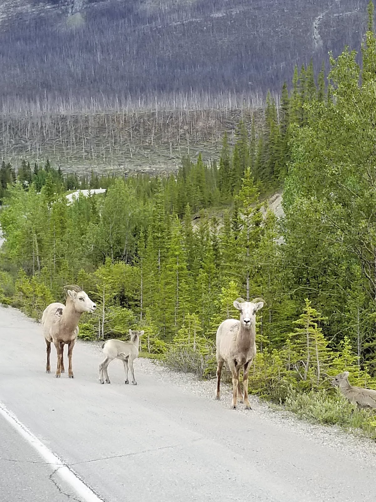
out for a stroll:
Gave Snowbird another, closer, look:

Took a photo of Hector Lake. At least, I think it was Hector
Lake. Oh well, it’s pretty no matter whose lake it is.

And made it out to Lake Louise, where Henry caused quite a stir
with this handsome pose:

Lake Louise is very photogenic. That’s Victoria Glacier above it
there, and I wish I were a better eavesdropper, so I could quote the park
ranger who was explaining to a tour group about how deceptively distant
Victoria is from Louise. I remember her saying that, when folks standing in
this spot see something happening on the glacier, there’s quite a delay between
the sight and the sound of the event! It looks so close, doesn’t it?


At Lake Louise we were still a couple of hours away from
Calgary. Plenty of time to research where we’d take our evening meal, as it had
been a while since that elk chili. Sue was hankerin’ for some sushi, so we
chose an Asian Fusion restaurant in a pretty cool downtown neighborhood.
Calgary seems like a nice, livable city as cities go.
But tomorrow we say goodbye to Calgary, because as wonderful as
this trip has been, it can’t last forever.
But boy oh boy, the memory of today will last forever! (Even
without having names for all the wondrous things we saw.)


More photos from the Forces of Nature Tour at Flickr.
Click here.
No comments:
Post a Comment