Sunday, June 3, 2018

Custer State Park and the Black Hills


Another packed day!

Our destination today was Custer State Park, and we chose a route that took us through Wind Cave National Park. Most of the attraction of this park is underground – the Wind Cave is one of the longest and most complex caves in the world. Native Americans knew this place for centuries, and regarded it as sacred. White men discovered the cave in the late 1800s, attracted by the whistling noise of the air coming out of the cave. Though we were unable – more like unwilling to leave the Henry-Dog behind – to explore the cave, we did pause to enjoy the prairie above it.

The soundtrack to this photo, if I could add it, would be the song of Meadowlarks.

This prairie dog was wholly unconcerned by my presence …

but this bison clearly regarded me as a nuisance!
Or maybe it was just letting me know: Hands off the calf, Missy!

On to Custer State Park, where we saw pronghorn antelope,


The animals rule here in their home! As they should. This pronghorn held up traffic for a while, as it did not merely cross the road but trotted along the road at a leisurely pace for a spell.

This picture was taken without telephoto. Believe me, I did not approach him, he approached where I was standing after he finally finished sauntering along the roadway. I was pretty leery of those horns, and when Henry finally spied him and started barking madly, I decided my time was up!

even more bison and prairie dogs …


and some of the friendlier and more popular residents of the park, the famous begging burros. Burros are not native to the Black Hills; these burros are descendants of beasts brought to help haul materials while building roads and bridges, and to carry sightseers. When they were no longer useful, they were turned loose to fend for themselves. Though non-native, they are still wild, and probably should not be fed. But how can you resist?

 Some of the burros are pretty pushy.


 But some are shy. 
Just call me the Burro Whisperer.


The white one, in particular, wanted the carrots but was deeply distrustful of anyone who approached. Perhaps this little creature had been badly hurt in the fires that ravaged the park last December. All of the burros were burned and subsequently treated by a veterinarian, but maybe this little one’s treatments were too painful, and now humans are associated with the pain.

Leaving the park we headed north, toward Keystone, and I could definitely see why this area is called the Black Hills. I guess it looks black from a distance because of all the granite, and maybe from the unusually dense-growing, dark variety of pine that populates the forest. The Native Americans called the hills “Paha Sapa,” which means “hills that are black,” and regarded them as sacred, a spiritual center which the Lakota Sioux called “Wamakaognaka E’cante” – “the heart of everything that is.”


Along the drive I caught my first glimpse of Mount Rushmore. We chose not to visit the actual site, however, as it seemed to us one view of the iconic landmark is just as good as any other view.

  
So we instead visited Sylvan Lake. This is a man-made lake, and a favorite recreation spot on a hot Sunday afternoon.


It was so good to see so many people enjoying a variety of activities at Sylvan Lake: hiking, fishing, swimming, boating, picnicking, bird-watching!


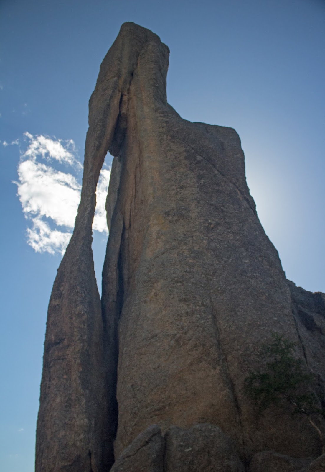
Leaving Sylvan Lake, we drove a winding and steep highway, to see the eroded granite pillars known as The Needles. 


Let me just say, I never knew how much there is to see and do in South Dakota. People from my part of the country tend to dismiss the Dakotas as vast, empty places. And we are dead wrong! The Black Hills are beautiful, the forests are majestic, and the prairies teem with wildlife. The people we’ve met are generally friendly and helpful, and seem to appreciate the unique recreational value of their state, rather than merely taking it for granted. We’re headed out tomorrow, but clearly we have barely scratched the surface of all that South Dakota has to offer. I’ll definitely be back this way one day.

More photos from the Forces of Nature Tour at Flickr.
Click here.


Saturday, June 2, 2018

in and near Hot Springs, SD

For what was supposed to have been a slow day, we sure have taken in a lot!

A late morning start and a 90-minute drive took us to Wounded Knee, back on the Pine Ridge Reservation.

We spied these two horses as we sped toward Wounded Knee. I think you'll agree, they were worth turning around for! 

We hadn’t even parked our car, before being accosted by a couple of Lakota trying to sell their wares. The man was particularly aggressive, thrusting a Chamber of Commerce publication into my hands and saying the Starbucks and Wal-Mart were just up the road. Sue and I both thought that was a rather odd remark, but said nothing. He kept handing me beaded trinkets, and the woman standing to his side, her hands full of similar items, finally challenged me, saying “You’ll look at his stuff and not mine?”

Both readily backed off when I told them I’d take a look at their wares after I’d done what I’d come for.

They were probably anxious to get their tourist season started. Sue and I evidently were the first tourists of the day.

We stopped to read two large signs that explained the events leading up to the Wounded Knee Massacre.1 The man kept interrupting our reading, wanting to talk. His talking was not entirely unwelcome, though. He reminded me of an event I’d all but forgotten: the 1973 standoff at that site.2


But I wanted to see if I could feel anything at Wounded Knee, the way I’d felt something profound at Culloden, in Scotland. And the two sites are similar, in that both were sites of harsh treatment meant to completely crush rebellion against an unwanted occupier – and both spelled the end of their respective native cultures.

I felt nothing at Wounded Knee, though.


A single stalk of millet stands as a sentry to this lonesome and neglected place.


The field was unkempt and full of crushed beer cans and other waste. I found myself wishing that the National Park Service had overseen this place. Surely they would keep it more pristine, so that it would be more possible to study and reflect.

But Wounded Knee does not belong to the US; it belongs to the Lakota, and I suppose it’s their right to make of it what they will. It was, after all, white men imposing their vision on red men that led to the Wounded Knee Massacre.

I bought a beaded necklace from each, the man and the woman, and I know from what each said to us that they were sorry to have judged us as tourists who were just “bagging” historical sites by spending a couple of minutes, buying souvenirs, taking a selfie, and then heading to the nearest Starbucks.

Fearing another pushy encounter with a different jewelry vendor, Sue and I did not choose to view the massed burial site at the top of a nearby hill; instead, we went to Porcupine – just for the name! 


Then we took an unpaved road through agricultural areas (once again, riding around off the map on Native American land!), to finally catch the road back to Hot Springs.


Along the route, I spied a Baptist church and wondered if it might be the church where my parents had done some mission work, years ago.

Stopping in the actual town of Pine Ridge, we grabbed a quick bite at the West’s ubiquitous Mexican fast-food joint, Taco John’s. Hey, isn’t it important to experience local flavors and customs? No one says you have to experience it ever again, right?

We took a look around the resort town of Hot Springs, which seemed as if it were waiting to awaken for tourist season.


This charming depot greeted many a visitor to Hot Springs, back in the day.

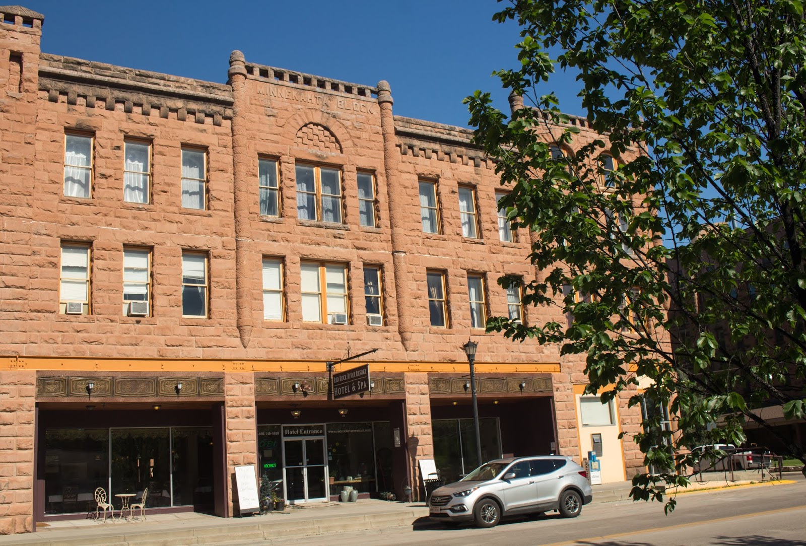
The hotel right across from the depot. Notice the name, up high on the building: Minnekahta, the Lakota word for "warm water." Minnekahta was regarded as a sacred site to the Lakota and the Cheyenne; the town was renamed Hot Springs in the 1880s.


Hot Springs boasts an impressive "collection" of sandstone buildings ...

... and this lone art-deco theater.

Braun Historic Hotel, just north of  the downtown on the Fall River. Check out the Filet Mignon price!

Then we visited the very impressive Mammoth Dig Site. Here, a large building actually covers the active dig of an ancient sinkhole, discovered entirely by accident in 1974. The site was being prepared for a housing development, when a bulldozer unearthed part of a Woolly Mammoth skeleton. The original building project was called off and the paleontologists called in.

It’s fascinating to see how a dig works!


Comparing the sizes of various mammoths, which you've never seen before, to the African Elephant, which you have.


Reconstruction of a Columbian Mammoth, the biggest of all the mammoths. He was SO HUGE, I was standing as far away from him as I possibly could, with my camera zoomed out as far as it would go, and yet this is as much of him as I could capture.

We finished the day with dinner at The Woolly, next door to the dig, which seems to be a favorite of locals.


2https://en.wikipedia.org/wiki/Wounded_Knee_incident


More photos from the Forces of Nature Tour at Flickr.

Click here.


Friday, June 1, 2018

from Sioux Falls, SD to Badlands National Park to Hot Springs, SD

What a day!

We rose a bit late and didn't take time for breakfast, although we did have coffee with some of that lovely Irish cream we'd bought yesterday. We hopped on to I-90 for the flat, boring ride to the Badlands.


After a while, we stopped for a picnic at a rest area that was being battered by wind whipping over the plains. It made us wonder about the people who once seasonally inhabited these plains. How rugged an existence!


On the road again, we spied this humorous roadside sign:


Sue has a friend who is a ranger at Badlands, and she had arranged for us to meet up so he could give us a tour. We arrived a bit early, so we ventured into the park by ourselves. Found a "road less traveled" where I could dawdle as I shot picture after picture. 


The Badlands got their name from the Lakota. Finding extreme temperatures, scarce water, and rugged rock formations, the Lakota called the area “mako sica” or “land bad”. Perhaps not so coincidentally, early French trappers called this place "les mauvaises terres à traverser", or "the bad lands to cross".

They talk about the dynamic landscape of the Badlands, and how their look changes throughout the day, as the sun arcs from sunup to sunset. The change can be almost a minute-by-minute, and I found myself wishing that we'd allotted far more time to this park, to see how it would look in the rosy glow of dawn or the rapidly-changing light of sunset.


We set back out for our rendezvous site: Minuteman Missile National Historic Site. Sue "babysat" Henry outside while I went inside and learned that there are quite a number of missile silos in the area -- Wow! The display was interesting and sobering but I didn't want to stay too long; besides, I lived the Cold War and found very little information that was brand-new to me.

Brad arrived and while he and Sue went into the Minuteman Site, Henry and I stayed outside. I tried to be more appreciative of the wind, and succeeded, taking this pretty shot of the sky which could only have been possible with winds:


We returned to the Badlands, where Brad proved to be a wonderful guide! He took Sue on a personal guided tour of the Enter the Door Trail, I checked out the Window Trail,


then Brad gave us access to the paleontology lab at the Ben Reifel Visitor Center -- which has not yet been opened to the public for the season. Though Brad is still fairly new to the park, he's obviously very quickly getting up to speed on discussing its unique geology, flora/fauna, and paleontological discoveries.

The remainder of our time with Brad was spent making our way to and through the Pine Ridge reservation, weaving in and out of the park, and much of the trip was along gravel roads.


It wasn't so evident in any of the previous photos, but here you can clearly see some of the different layers in the Badlands buttes. The Badlands area was once covered by a giant sea, and the oldest fossils are of marine animals. As I understand it, the reddish layers you see are bands of sandstone marking the course of ancient rivers that flowed from the Black Hills. The rugged peaks were once volcanic ash deposits, now hardened but still fragile. 

The grayish layers are from the river flood plain, a lush subtropical forest, that replaced the ancient sea. Each time the rivers flooded, they deposited a new layer on the plain.

These yellow mounds were one of my favorite sights in the Badlands. The sea drained away with the uplift of the Black Hills and the Rocky Mountains, exposing black ocean mud to the air. Upper layers weathered into this yellow soil. Geologists don't completely understand this particular layer.

Looking toward the Pinnacles, from Yellow Mounds Overlook.

Moving beyond the Yellow Mounds, these Bighorn Sheep had attracted quite a crowd ...


but as I happily snapped pictures, Sue's attention was drawn to a man who was quietly eating his lunch, and ever so casually checking out a different scene: 

No one else noticed the babies, and no wonder! Their coloring is perfect camouflage for the rocky, scrubby terrain.

This Bighorn couldn't have cared less about the fact that I was taking her picture from a car only a few feet away.

The Prairie Dogs are a tourist favorite, as are the Bison.


The next two photos were taken in Scenic. Yes, there is a town named Scenic. And notice the 1906 version of the "We reserve the right to refuse service ... " sign.


We said goodbye to Brad at White River Visitor Center

Sue, with Brad

and set out once again, to skirt along the Badlands National Park onto the Pine Ridge Reservation. Look at the castle on the hill. Look again. It's not a castle but a rock formation.


I'll be honest with ya: After parting company with Brad, we weren't 100% certain where we were. Swell. Last year, low on gas, we got lost on the Zuni Reservation (New Mexico). This year, low on gas, not as lost -- but still lost! -- in Oglala Lakota territory. But eventually we ended up at this town called Buffalo Gap, which seems to be revitalizing as an artist community.


Once in Buffalo Gap, we were back onto Rand McNally Atlas territory, and easily found our way to the Hot Springs KOA, where we'll be spending the next few nights.

As Henry and I took his last walkie of the night before bed, we went down a lane that was bordered on both sides by high trees. The trees shielded us from the lights of the campground, and the effect was that millions of stars appeared to pop out! I have never before experienced such total darkness, which was only possible because there were no street lights and we were far, far away from the light pollution of a city. It was amazing!


More photos from the Forces of Nature Tour at Flickr.
Click here.